Background
Scope
Overview
Implementation
Tasks
Assessment and Monitoring
Legacy
Invasive Control Plan
Public Outreach and Education
Collaboration and Coordination
Project Contacts
Invasives Removal Grant
Background
In June 2004, the State of California with Prop 13 funds granted $3.96 Million for the Dr. Alan Thum Invasives Removal Project in the Carlsbad Hydrologic Unit Riparian Zones to remove the most threatening invasive plant species (i.e. arundo, tamarix, pampas grass, and palms) from over 250 acres of the CHU, as well as controlling the secondary species.
This large scope of this project is essential to gain control of the extensive invasive exotic plant species problem and was carefully conceived to make maximum use of the existing expertise, knowledge, and resources that can be brought to bear on the major problem of the severe infestation by invasive plants of the seven watersheds of the CHU. The project implements invasive species control and habitat restoration at a scale that makes sense and will be most effective for the CHU: along entire, small watersheds, and across adjacent watersheds.
This project is expected to significantly improve the conditions, functions, and values of the riparian/wetlands habitats by reducing the detrimental processes and increases the ability of the riparian/wetlands to sequester contaminants, increase pathogen mortality, reduce flooding and resulting bank erosion, and reduce sediment transport. Another expected outcome is reduction of backwater flooding, the potential for debris jams on bridges and trestles, and the substantial accumulated fire fuel load.
The Watershed Management Plan for the CHU, or "Carlsbad Watershed Management Plan" (CWMP), completed in 2002, called for a comprehensive approach to invasive plant species control and removal, among other recommendations:"A major effort to remove these invasive plants and to restore native vegetation in these watersheds is critical to reestablishing the hydrologic and ecological functions of these riparian and coastal wetland habitats."
This project also implements the goals and objectives of the San Diego RWQCB, as framed in their Watershed Management Chapter.The project will effect NPS (Goal 2g) to "Prevent the introduction of non-native invasive species. Eradicate such species that are already established, where possible. Where eradication is not possible, remove, control, prevent the spread of, and reduce impact of and area occupied by such species."The project will provide hydrologic information and restoration measures that will address sedimentation and siltation issues, which were identified as the most important long term management need of the Carlsbad (CHU) Watershed Urban Runoff Management Plan (WURMP).
This grant was a culmination of years of work by Carlsbad Watershed Network as a whole and by Dr. Thum, a CWN participant who crafted the pre-proposal for this grant prior to his untimely death on May 14, 2003. The San Elijo Lagoon Conservancy applied for and is the recipient and fiscal agent for this project on behalf of the CWN. This project illustrates the CWN role as an effective and committed collaborative and demonstrates its capability to carrying out such an ambitious and timely project. The CWN focused on this project as it addresses a widespread or common problems within the CHU as a whole, does not duplicate efforts being carried out either by municipalities as part of the NPDES process, or by individual wetland or watershed conservancies.
Project Overview
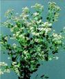
Invasive Plant Species Removal and Habitat Revegetation
The basic aim of the Invasives Removal Project is to remove the predominant species of invasive plants and to restore native vegetation in these watersheds as an essential step in reestablishing the hydrologic and ecological functions of these riparian and coastal wetland habitats.
Preliminary estimates of acreage needing clearing include:
142 acres of pampas grass (Cortaderia sp.)
90 acres of giant reed ( Arundo donax ),
18 acres of palms, ( Washingtonia fillifera)
14 acres of salt cedar (Tamarix sp.)
4 acres of other invasives,
278 Total acres
.
This project puts into place a comprehensive plan to remove as much acreage of the most invasive plant species that threaten riparian and wetland systems within the CHU as possible, to remove those species in a sustainable way (i.e. with accompanying native habitat restoration, and/or the establishment of conditions to ensure the long-term exclusion of new infestation), and to maximize the possibility of natural regeneration of desirable native habitat, thus reestablishing beneficial uses to surface waters where possible.
In conjunction with invasives removal, revegetate cleared areas with native species in selected reaches prescribed for each sub-watershed or other management subunit
This task is the core of the project, the replacement of invasive exotic plant species with native riparian vegetation in order to restore ecological functioning of the watersheds. This task results in the removal of invasive exotic plant species and their replacement with native ones, increased ecological functioning of the watersheds, and improved water quality. Methods to be used will be effective at the scales appropriate to each specific population of invasive plant, approved by the reviewing resource agencies, and with minimal long-term negative habitat impact.
Project Scope
The major components of the Invasive Removal Project are as follows:
-
Locate and map the non-native invasive vegetation and native riparian and wetland vegetation at a scale and accuracy that establishes a good baseline for measuring project effectiveness and tracking future conditions of the habitats under a Weed Management Area to be initiated as part of this project;
-
Use established, effective means of removing exotic invasive plant species that will reduce the likelihood of re-infestation;
-
Consult the resource agencies in order to ensure the minimum impacts possible on watershed ecosystems;
-
Use active and passive revegetation at paired sites to compare the efficacy of both approaches;
-
Measure water quality, benthic macroinvertebrates, and habitat parameters before and after site treatments to determine ecosystem improvements;
-
Develop an adaptive Invasive Species Management and Habitat Restoration Plan for the CHU;
-
Use public outreach and education to elucidate the connection between individual behaviors and watershed health, to gain support and long-term buy-in for the project, and to engage the public in reducing factors that contribute to the sustaining of exotic invasives.
Project Outcomes
The project outcomes include:
Make significant progress in re-establishing the hydrologic and ecological functions of the riparian and coastal wetland habitats within the CHU through the removal of invasive exotic pest plants over large areas and their replacement through the most effective means available with appropriate native habitat. To reduce anticipated future consequences of accumulated fire fuel, flood debris jams, and loss of native riparian/wetland biodiversity.
-
Use the deep understanding of the problem of exotic invasive species in wetland habitats, developed by the members of the CWN over the past five years, and their significant commitment towards its solution throughout the CHU, to effect a comprehensive and efficient program for the eradication of the invasives, and the restoration of beneficial uses to wetland habitats.
-
Put in place reliable mechanisms to ensure the long-term continuation of efforts to control invasive exotic species in wetland and riparian areas, through the development of an Invasive Species Management and Habitat Restoration plan for the CHU, which would include such measures as the establishment of a Weed Management Area (WMA).
-
Contribute significantly to the understanding by the general public and the horticultural trades of the detrimental effects of exotic invasive species in the watershed in general, and in riparian and wetland areas in particular. To elucidate alternatives to current practices in horticulture that will reduce the threat of exotic invasive plants.
-
Reduce contributions to Category 1 impaired water quality conditions through enhanced community understanding and capacity to manage water quality.
-
Make available information and experience gained from this effort for use in other affected watershed management areas in the state (per SDRWQCB WMC).
Project Implementation
The San Elijo Lagoon Conservancy (SELC) is coordinating all project tasks and engaging contractors to supplement their own staff and is carrying out the physical, analytical, and administrative tasks. SELC has experience in the arena of major invasive plant removal, having completed two major projects in the 1000-acre San Elijo Lagoon Ecological Reserve.
Although this project is being managed by the San Elijo Lagoon Conservancy, a 501(c)3 organization and CWN founding partner, it is being implemented cooperatively in each watershed via each of the relevant NGO, municipal, and county organizations with input from the other governmental agencies.
The project was planned at the whole watershed level and is being implemented by the creek reach and subwatershed (Claytor 2000). In the process, the project enhances collaboration and coordination among multiple stakeholders, and contributes to more effective water quality and/or watershed management.
Projects Tasks
-
CEQA/NEPA Documents and Permits, is intended to address environmental impacts and mitigation needs early on, so that permits will be in place prior to actions that require them.
-
Project Planning, includes several plans that layout project implementation procedures, and ensure project efficiency, and the usefulness of results.
-
Adjoining Landowner Notification, will meet requirements of the SWRCB, and will be one of the means of involving these stakeholders and gaining their permission for access for invasives removal;
-
Aerial Photographic Survey, will allow us to obtain up-to-date, high resolution data that will ensure accurate data for measuring the baseline extent of invasives'infestations upon which to base efficient application of invasives removal efforts, as well as being a necessary reference for monitoring efforts.
-
Mapping Plant Communities, focuses ground-based efforts on the riparian areas and uplands with infestations of invasives that could impact the riparian areas; this is necessary to confirm and clarify information obtained via the aerial survey, and will be necessary to track invasives'removal effectiveness;
-
GIS Database Management of Data Layers, will provide a repository for the extensive spatial data that will be obtained throughout this project, including the aerial survey, and mapped data on plant communities and water quality. It will allow the results of this project to be summarized in map form, and to be accessible for analysis.
-
Invasive Species Management and Habitat Restoration Plan, will provide the overall strategy of this project, including invasive species management plans for each of the watersheds in the CHU, with goals, objectives, timelines, and methods for each of these. It will prioritize the work of the current project, and will incorporate data derived from this project into an adaptive management plan for invasive species control as part of an overall watershed protection and restoration effort described in the CWMP.
-
Public Outreach, is essential for informing public entities, businesses, the general public, and public and private landowners in a timely manner regarding the goals, methods, and benefits of the watershed restoration activities to be undertaken through this project, particularly the removal of exotic invasive species. It will be essential to ensuring political and individual support for this and related projects that seek to protect and enhance the watersheds of the CHU.
-
Invasive Plant Species Removal and Habitat Restoration, is the core effort of the project, through which it is anticipated that 80% of the tier I infestations most damaging to riparian zones will be removed from the CHU. Planning and execution will draw upon all the preceding tasks to ensure safety, effectiveness and efficiency in carrying out the work in a manner that will result in the least damage to the environment while providing the greatest benefit in terms of significantly improved beneficial uses of the watershed.
Project Assessment and Monitoring
This project is being monitored and its performance evaluated in order to ensure effective use of public funds. The monitoring and performance components include assessment of project implementation and provide scientific measurements of effectiveness. The components are as follows:
-
Project Assessment:Scientific studies include treatments at stratified sites, approximately one site per 5 miles of main stem blue line creek throughout each watershed, which reflect the range of watershed conditions in the CHU. If "facilitated restoration" (via re-vegetation) proves to be not necessary, we can devote more money to invasive species removal and less to re-vegetation, and greatly accelerate "restoration" of these and other watersheds in San Diego County.
-
Water Quality Assessment:The municipalities in the CHU currently measure over 40 analytes at about $800/sample. These data will be used to document baseline conditions and to help assess the effectiveness of the project to reduce contaminant loading. Field sampling as part of the current project is being carried out on specific reaches that are targeted for invasive species removal and will be used to enable scientific investigation of the relative efficacy of different treatments to be employed to improve water quality.
-
Bioassessment: Point source methods per the California Department of Fish and Game are being used to sample above, within, and below selected experimental sites. Protocols conform to the standards and procedures in use throughout San Diego County for comparative purposes.
-
Habitat Assessment:Baseline monitoring includes surveys for vegetation, avifauna, and for rare, threatened, and endangered species, in order to avoid or minimize impacts to wildlife and native vegetation. The vegetation sampling variables include: number of invasive plant species; vegetation level (herbaceous, shrub, or tree); type of treatment (removal method and controls); re-infestation; native regeneration or survival of revegetated stock; etc.
-
Hydrologic Assessment:Modern technology such as a bubble or transducer system are used to obtain a finer-scale view of the hydrology of each of the creeks in which experimental vegetation manipulation is being carried out. These data will contribute to cities'compliance with the NPDES Permit and to future TMDL analyses.
-
Outreach Assessment: Outreach monitoring includes measures to quantify watershed awareness and the increase in active participation in watershed protection through NGO formation and volunteer efforts that are brought about by this project; these are very important for ascertaining the ability of the public to continue to sustain invasive plant species control efforts and therefore to continue non-point source water quality impacts in the future.
Project Legacy
Besides the physical removal and restoration of more than 250 acres of invasive plants, this project will leave a legacy of planning, enhanced coordination, and public involvement in invasive removal.
Invasive Species Management and Restoration Plan
An integral part of this project is the development of a long-term Invasive Species Management and Habitat Restoration Plan (ISMHRP), which will guide continued efforts throughout the CHU for up to 20 years. As part of that effort, we plan to formally establish the CHU as a "Weed Management Area," (WMA) so that the CWN will have a long term mechanism and other sources of funding for continued management of any re-growth and colonization by new invasive exotic plant species beyond the contract period of the project. The Carlsbad Watershed Management Plan (CWMP 2002) for the CHU explicitly calls for the development of a comprehensive invasive plant species control program to be implemented in each of the seven component watersheds.
An invasive species management and habitat restoration plan specific to the CHU will be developed with input from the aerial photography, vegetation mapping, and GIS database to prepare the overall temporal and spatial implementation strategies for each watershed and subwatershed or other management subunit. Implementation methods, priorities, and timing of treatment of the stream reaches will be determined using a variety of criteria, including:
-
Invasive plant species present, and their characteristics including level of threat, density, phenological stage, and distribution;
-
Riparian area or creek access, adjacent land use, and degree of imperviousness;
-
Location within the subwatershed; potential for reinvasion or new colonization;
-
Property ownership, and established agreements for particular properties;
-
Hydrology, including creek topographic elevation and perennial flow;
-
Stream morphology, i.e. main stem, 1stor 2ndorder creeks
-
Seasonal nesting of possible rare, threatened, endangered species, or species of special concern;
-
Appropriateness of chemical or mechanical removal, and management of biomass;
-
Potential of sites for "experimental revegetation" and native species palette;
-
Potential to complete a major watershed creek segment or number of subwatersheds.
Phase I of the Invasive Species Management and Habitat Restoration Plan (ISMHRP) will be a framework in which this project's focus of removing invasive plants over large areas, significant inventory and mapping, and scientific investigation of the relative benefits of passive habitat regeneration and active revegetation as restoration techniques will play a major role.
Phase II of this plan will lead the way to the follow-on actions that will be needed after the current project is concluded. The ISMHRP will provide a framework for monitoring, in the short and longer term, both the return of desirable habitat and beneficial uses, as well as the introduction, spread, or return of undesirable species where they may have been removed during this project.
Such a plan is also necessary to ensure the public's engagement in the battle against invasive exotics in the future, and will therefore incorporate the lessons learned and contacts made through the outreach component of the current project. It is anticipated that it will be an adaptive management plan that will incorporate the results of this project and other future projects in order to make it continuously up-to-date in terms of data and strategies for invasive species control, and that it will continue to evolve as the needs of the CHU to respond to known and as-yet unknown threats and solutions are uncovered. The ISMHRP should be a core component of the initial initiatives of the WMA that is to be formed as part of the project.
Stakeholder Involvement and Public Education.
The methods for the outreach education use accepted instructional methodologies that enhance learning, understanding and application of knowledge to "real world" situations. It takes the conceptual model of environmental stewardship that has been tested in school-based contexts and transfers it to public outreach. This project illustrates how human intervention can support the rejuvenation of natural functions of environmental systems to improve surface water quality. The program methodology is designed to inform, to involve and to change the behavior of citizens in protecting the natural resources of the watershed.
The method by which we inform our audiences will include interactive demonstrations facilitated by a 6'X8' true-to-scale topographic map of the CHU with brilliant full-color high resolution printing of satellite imagery or aerial photography on the three-dimensional surface. In addition, three stand-alone computers will be programmed with scenarios (ARCView and other visualizing software) illustrating the past, present and future states of watershed and its functions. These scenarios will be designed using the GIS data layers that have been developed through other projects and agencies, aerial photography and ground-based vegetation mapping (tasks 6 & 7). Likewise, the data collected from the water quality, habitat and hydrological monitoring will also become additional layers. The scenarios will be made "friendly" and easy to access, and give the participant a virtual experience of the environmental functions of watersheds. In particular, this project focus will look at the pristine, before and after effects of the invasives removal. These might include the changes to: hydrology, riparian/trophic structure, organic loading, nutrient spiraling, etc. These scenarios will be designed for educating a range of audiences including school age students, municipal employees, policy makers, businesses, agricultural operations, and residents of the CHU. The interactive exhibit will become a part of the permanent exhibits at the new Agua Hedionda Lagoon Discovery Center and will be available to over half a million residents and employees in the CHU.
Enhanced Collaboration and Coordination
The seven municipalities recently collectively sanctioned a new Multiple Habitat Conservation Plan (MHCP) (SANDAG 2003) that covers the seven watersheds. The project will be a major step in underpinning the new MHCP by increasing the ecological performance of these watersheds. We anticipate that the shared experience of the project will facilitate acceptance and implementation of "Watershed Based Zoning" critical to sustaining long term watershed functions.
Most of the non-governmental organizations (NGO's) in the CHU have tended to focus on local individual or segments of water bodies, e.g. lagoons, creek tributaries, or lakes; cities typically only manage within their jurisdiction; and counties manage at the regional level. Recently, these organizations have begun to cooperate at the whole watershed level. Three NGO's, three cities, the county, and three resource agencies recently signed the Escondido Creek and San Elijo Lagoon Watershed Cooperative Agreement (WCA, 2003) to facilitate coordinated conservation, management, and planning in the Escondido Creek Watershed. The structure of this agreement, the first in the County, is being used as a model for initiating other potential watershed cooperatives. The project will foster this level of communication, and will be coordinated and facilitated locally through this new WCA. In the Aqua Hedionda Watershed, cooperation between the Aqua Hedionda Lagoon Foundation, the Regional Workbench Consortium, and the UCSD Natural Reserve System will expand the capability of the new Discovery Center to enable study of the entire watershed. The outreach component of the project will be one of the first watershed-scale efforts of this new facility, demonstrating the power of this new approach.
Members of the CWN have also established an active citizen volunteer Stream Team monitoring program, which implements California Department of Fish and Game's Rapid Bioassessment Protocol (2000) in three of the watersheds, empowering residents to monitor and manage water quality of their local streams.
Project Contacts
Project Director: Doug Gibson, 760-436-3944
Field Coordinator:, Amy Trujillo, 760-427-2665
Project Outreach/Education: Merle O'Neill, 760-598-7783
Project Scientist: Isabelle Kay, 858-229-4677