Role of Coastal Streams, Wetlands and Lagoons
Overview of the Carlsbad Hydrologic Unit
Environmental Degradation
Invasive Plant Problem
Watershed Management
Virtual Tour
Role of Coastal Streams, Wetlands and Lagoons
On their way to the ocean, California’s coastal streams and rivers flow through the canyons and valleys of coastal mountains, linking forest, chaparral, scrubland, grassland, and marsh habitat. Riparian woodlands develop along stream banks, floodplains, and coastal wetlands and estuaries form where the rivers enter the sea. Rivers transport nutrients, sediments, and oxygen through the watershed, and life flourishes in their path.
Coastal rivers historically play a crucial role in replenishing sand lost from beaches. Now days, in Southern California, where rivers run intermittently, stream sediments reach the beaches only during large storms and floods. Dams, highways and urban development along these rivers have reduced their natural sediment loads, resulting in serious loss of sand supply and erosion problems on south coast beaches.
Coastal wetlands and lagoons include a number of natural communities that share the unique combination of aquatic, semi-aquatic, and terrestrial habitats that results from periodic flooding by tidal waters, rainfall, or runoff.
Wetlands provide a habitat for a vast array of organisms, including many endangered species.  During peak annual migration periods, hundreds of thousands of birds migrating along the Pacific Flyway descend upon these coastal wetlands in search of refuge and food. Coastal wetlands provide a vital link between land and open sea, exporting nutrients and organic material to ocean waters, and harboring juveniles of numerous aquatic species including many fish. Water flow in these highly productive communities circulates food, nutrients, and waste products throughout the system.
Wetlands also buffer the effects of storms, reducing shoreline erosion, and improve water quality by filtering and assimilating many pollutants from urban runoff, spills and agricultural runoff.
The above description is based on excerpts from the California Coastal Commission’s California Coastal Resource Guide, which can be ordered from the University of California Press.
Watershed Definitions and Fundamentals, Chapter 2 of the Carlsbad Watershed Management Plan, contains a detailed examination of what a watershed is and how a watershed works courtesy of Project Clean Water.
Overview of the Carlsbad Hydrologic Unit
The Carlsbad Hydrologic Unit (CHU), known as the the Carlsbad Watershed is the third most densely populated area in the County with its population growth projected to increase from 500K in 2000 to 700K by 2015.
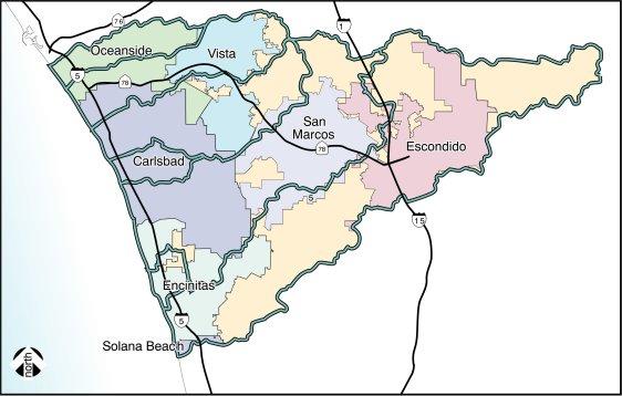
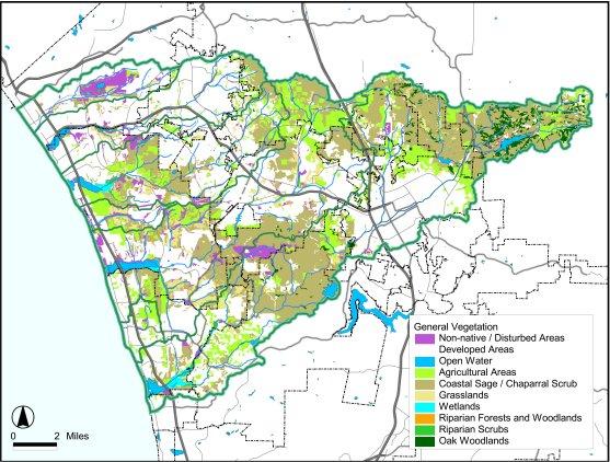
The Carlsbad Hydrologic Unit (CHU) is a 210 square mile area in northern San Diego County that extends well beyond the boundaries of the City of Carlsbad. It covers substantial portions of the cities of Oceanside, Vista, San Marcos, Escondido, Encinitas, and Solana Beach in addition to significant unincorporated portions of the County of San Diego.
The CHU encompasses seven adjacent coastal watersheds that drain to the Pacific Ocean including the Loma Alta Creek, Buena Vista Creek, Agua Hedionda Creek, San Marcos Creek, Escondido Creek, Canyon de las Encinas Creek, and Cottonwood Creek. The CHU contains four major coastal lagoons: Buena Vista, Agua Hedionda, Batiquitos and San Elijo as well as the Loma Alta Slough.
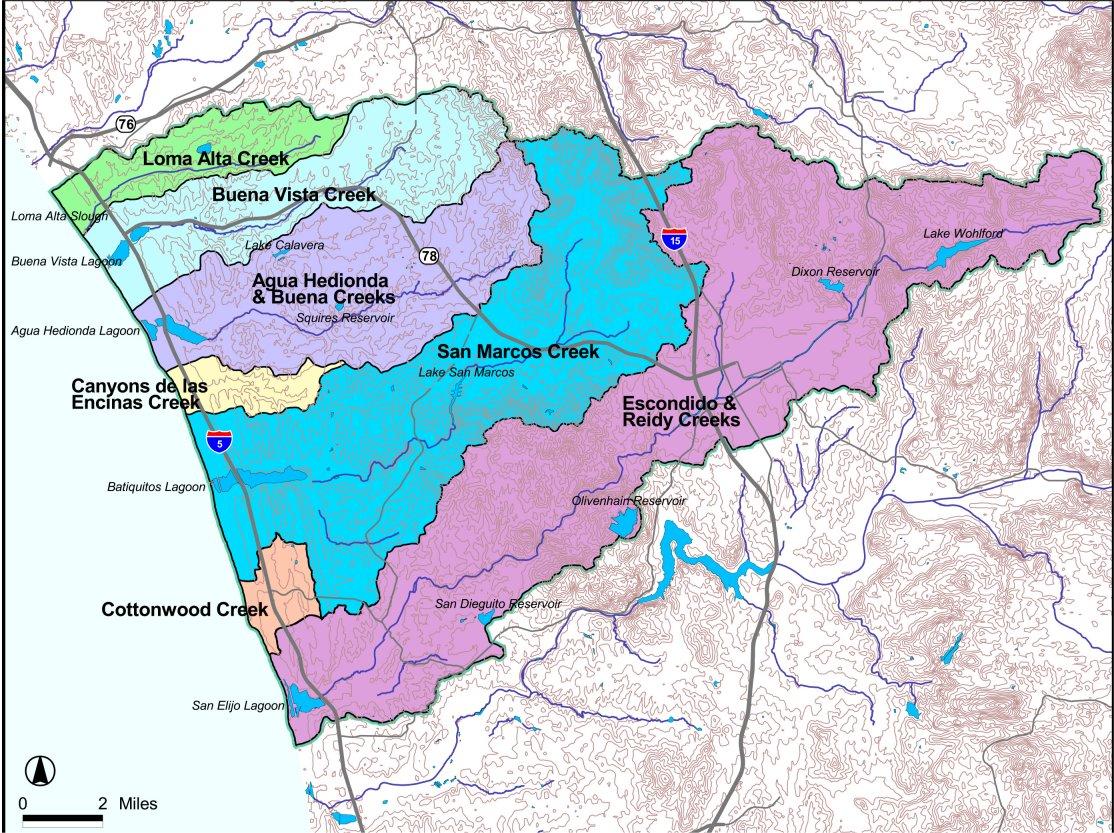
The CHU also includes three lakes, two storage reservoirs, urban and natural drainage, native vegetation, open space, beaches, agriculture, aqua farms, recreational facilities, and power and desalination plants.
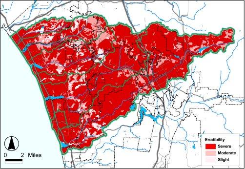
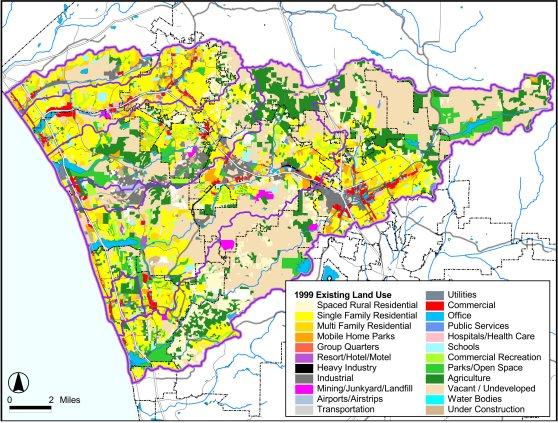
Impervious surface estimates in the CHU average 18%, ranging from 13% in the Escondido Creek watershed to 33% in the Cottonwood and Encinas Creek watersheds. The CHU faces significant demand for new development to accommodate anticipated population increases during the next 20 years. The new development will adversely impact the CHU and increase the amount of impervious surface increasing the amount of water runoff that can lead to flash flooding, erosion, and riparian and wetland habitat destruction, not to mention increased pollution.
More about the Carlsbad Hydrologic Unit is available at San Diego County's Project Cleanwater website.
Environmental Degradation in the CHU
Southern California especially San Diego County is known as a hot spot for high bio-diversity and a high concentration of endemic species i.e. species native to this area and found only in this area with comparatively restricted habitat and distribution e.g. the gnat catchers which is a listed and threatened species. The endemic wildlife and plantlife in San Diego County is particularly vulnerable as evidenced by increases in threatened and endangered species due to habitat destruction as a result of urban development . This destruction is also reflected in the deteriorating quality of surface waters in the region.
“All water bodies in San Diego County are polluted; some to a greater or lesser degree than others. Urbanization is seen as the primary cause of non point source pollution. 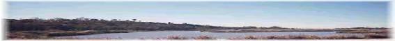
Erosion, natural or mechanically induced, silts the waterways and contributes to flooding. Exotic vegetation and invasive water weeds,have been choking the waterways at an increasing rate," according to the San Diego Resource Conservation District.
Similarly, the creeks and lagoons within the CHU face significant degradation, pollution, and sedimentation. Data regarding water quality and stream health reveals that their waters are in "very poor" or "poor" condition.
Overall watershed ecosystem health issues include:
- erosion and sedimentation,
- loss of native species,
- pollution from non-point-source runoff and direct discharges,
- habitat degradation and loss,
- loss of wetlands and riparian habitats,
- constrictions of wildlife movement corridors.
Many of the streams and receiving waters in the 135,322 acre Carlsbad Hydrologic Unit (CHU) are in poor condition and are continuing to deteriorate largely because of how water is used, increased development in San Diego County, and lack of public knowledge of the severity of the existing water quality problems within the creeks and lagoons.
In addition to invasive infestations, the creeks and streams have the following problems.
| Loma Alta Creek and Slough | High Coliform, Euthrophic |
| Buena Vista Lagoon | High Coliform, Nutrients, Sedimentation and Siltation |
| Agua Hedionda Lagoon | High Coliform, Diazinon & TDS |
| Encinitas Creek | Diazinon, Euthrophication, Malathion |
| San Marcos Creek | Sedimentation and Siltation |
| Batiquitos Lagoon | High Coliform |
| San Elijo Lagoon | High Coliform, Sedimentation and Siltation, Eutrophic |
| Escondido Creek | High Coliform |
The Agua Hedionda, Buena Vista, and San Elijo lagoons are experiencing impairments to beneficial uses due to excessive coliform bacteria and sediment loading from upstream sources. Two of these, the creeks in the CHU have chronic bacteria beach closure problems and four drain into ecologically significant coastal lagoons (i.e. Buena Vista, Agua Hedionda, Batiquitos, and San Elijo)
These coastal lagoons represent critical regional resources that provide freshwater and estuarine habitats for numerous plant and animal species and are essential components of the Pacific Flyway for migrating birds. The well being of these watersheds has an enormous influence on the stability and productivity of the coastal lagoons as habitats directly impacting Pacific Flyway migrating birds, commercial fisheries, and beach conditions.
 There is an urgent need to take steps to avoid irreversible degradation. Habitat protection, restoration, and acquisition are needed in order to forestall further fragmentation of natural habitats, loss of populations of sensitive species, and degradation of ecosystem functions.
Problem Description
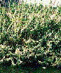
Exotic invaders both above and below water crowd out native plant and wildlife species. These invaders spread because they have no natural predators in the local eco-system. Here are just a few of the most egregious examples:
 |
Arundo which spread during floods is clogging rivers and streams. See full color brochure on this invader. |
 |
Pampas Grass increases the state’s susceptibility to summer wildfires. See full color brochure on this invader. |
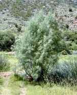 |
Salt Cedar drinks up water and prevents survival of native vegetation during dry periods. |
 |
castor bean (Ricinus communis). Myoporum laetum, This non native is poisonous. See full color brochure on this poisonous invasive. |
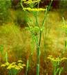 |
Fennel crowds out sage scrub and grasslands habitats. |
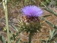 |
Artichoke Thistle makes rangeland unsuitable for grazing animals. |
Today, only 4% of California’s native streamsides remain according to some sources.
According to Biologist, Jeffrey Lovichor of the National Biological Service, "Invasive plants are one of the greatest challenges to ecology we face today."
Excerpted from "Exotic Species Crowd Out Native Plant Species"by Steve La Rue, Staff Writer, San Diego Union Tribune.
For more information on invasives and invasive removal:
- Go to Invasives Page for a more detailed look at the invasive problem in the CHU including plant, aquatic, and animal invasive species.
- See an expanded list of invasive plants causing problems in the CHU. .
- Print the brochures on the most problematic invasives in our watersheds.
- Read the Union-Tribune article on the Invasives Removal Project.
- Learn about the full removal and scientific scope of the Invasives Removal Grant
Watershed Management
Water features do not recognize jurisdictional boundaries. To protect these resources, a "watershed approach" must be taken that recognizes the relationship between upland areas, stream conveyances, and receiving waters as well as the interaction between habitats, land uses and human activity.
The Carlsbad Watershed Management Plan ( CWMP ) is the framework for cooperative watershed management of the Carlsbad Hydrologic Unit by local ![]() governments, agencies, organizations, and other watershed stake holders. It describes the current conditions of the various watersheds within the CHU and a plan of action to protect, enhance and restore the CHU.
governments, agencies, organizations, and other watershed stake holders. It describes the current conditions of the various watersheds within the CHU and a plan of action to protect, enhance and restore the CHU.
The purpose of the WMP is to provide a vision for the resource management of the CHU by:
- Identifying goals
- Specifying actions to reach those goals,
- Outlining a strategy for implementing these actions,
- Determining the responsibilities of various stakeholders in the strategy implementation and
- Prescribing a measurable monitoring program to determine how well the actions have implemented the vision.
The Carlsbad Watershed Management Plans calls for protection, restoration and enhancement of undeveloped open space in the headwaters to the coastal wetlands of the watershed that will provide natural filtering capabilities for water runoff control and water quality improvements. Also, it calls for the purchase or transfer into public ownership or control of as many of these wetland resources as possible.
Watershed Management Plan
See Carlsbad Watershed Management Plan (CWMP) for an outline of the goals, plan elements, objectives and action items. as well a description of various plan components. A complete copy of the CWMP in PDF format is available courtesy of Project Clean Water.
Virtual Tour of the Carlsbad Hydrologic Unit
Take a short virtual tour of the Carlsbad Hydrologic Unit in maps or photos found in the Carlsbad Watershed Management Plan
